


La Grave J04

Airelle
User
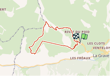

Length
16.9 km

Max alt
2522 m

Uphill gradient
1061 m
Km-Effort
31 km

Min alt
1737 m

Downhill gradient
1049 m
Boucle
Yes
Creation date :
2020-09-23 07:34:24.0
Updated on :
2020-09-23 15:11:47.929
6h38
Difficulty : Medium

FREE GPS app for hiking
 SityTrail
IGN / Geographical institutes
SityTrail Plus
The world is yours!
About
Trail Walking of 16.9 km to be discovered at Provence-Alpes-Côte d'Azur, Hautes-Alpes, La Grave. This trail is proposed by Airelle.
Description
Plateau d Emparis
Positioning
Country:
France
Region :
Provence-Alpes-Côte d'Azur
Department/Province :
Hautes-Alpes
Municipality :
La Grave
Location:
Unknown
Start:(Dec)
Start:(UTM)
286093 ; 4992671 (32T) N.
Comments